Welcome to part five in New Zealand: A Hiker’s Paradise, where I write all about hiking in New Zealand. This week, I want to talk about hiking in New Zealand’s South Island southern half, particularly hikes in Otago (near Dunedin), the Catlins, Southland, Fiordland, and Stewart Island. In part one, I talked about the differences in climate and geography as you go further south in the country, so it should come as no surprise to you that most of the hikes on this list are a little more strenuous and require a moderate level of fitness.
You’ll want to consider the time of year that you are going to hike, and prepare accordingly. On many of these trails, the weather can change dramatically over the course of an afternoon. Plan to carry rain gear and – even if hiking in the summer – a warm layer. Cotton layers aren’t great for hiking; wear and pack clothing designed for outdoor hiking. With all that being said, read on for what to know about hiking in New Zealand’s South Island.
If you missed parts one through four, read them here: one, two, three, and four.
 Dunedin
Mount Cargill walk
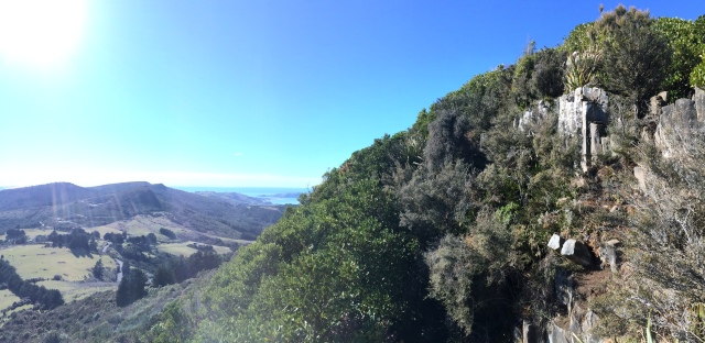
Mount Cargill is the mountain that overlooks the city of Dunedin; it’s easy to walk up it from the Bethune Gully, or you can park near the start of the Organ Pipes track and then cross the saddle from that hike. Both tracks make up the end of the Skyline Tracks, which start at the Flagstaff-Pineapple Walk.
Flagstaff-Pineapple Walk
 {image from Rushleigh}
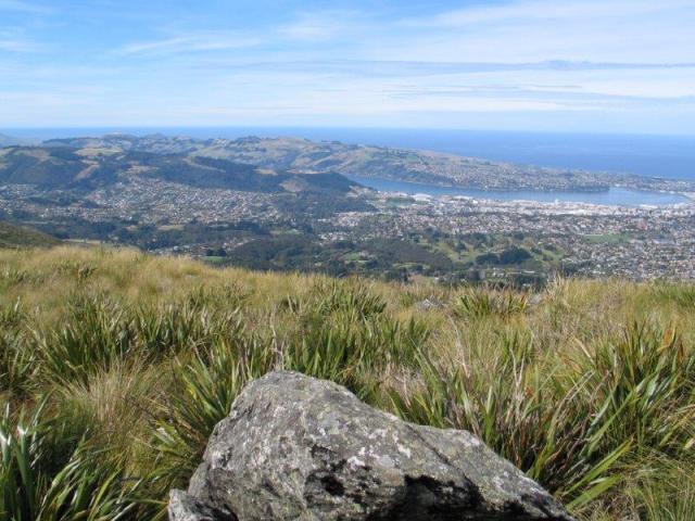
The start of the Skyline walks, this is also a fairly challenging walk. The name comes from the empty pineapple tins that trekkers used to leave tied to the trees after a rest at the summit. Trail starts at Flagstaff-Whare Flat Road.
Tunnel Beach
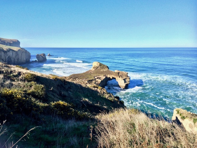
Located just a ten minutes drive out of town, Tunnel Beach is a popular local spot. It takes about an hour round trip, but you’ll likely spend time at the bottom. The walk down is easy; the walk up is quite steep. One of my favourite places in Dunedin!
Otago Peninsula
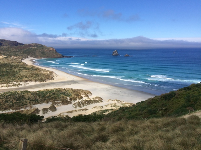
There are a lot of walks on the peninsula. These walks range from twenty to thirty minutes up to a few hours, and there’s the option to link some up as well. From Sandfly Bay, you can walk through the dunes to Lovers Leap, for example. It’s easy enough to spend a day on the peninsula; definitely take time for it. Pick up a brochure of Otago Peninsula walks from the iSite in the city centre.
Rock and Pillar Range
 {image from Wikimedia Commons}
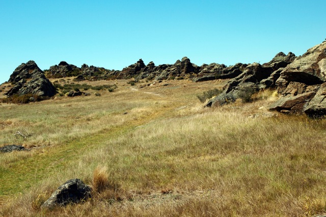
An hour from the city are these unique schist formations that dominate the skyline. The road is closed in the winter but accessible the rest of the year to all vehicles. The DOC gives a good breakdown of the various trails and locations in the Middlemarch area. Don’t miss the loop track around Sutton Lake, the only inland salt lake in NZ.
The Catlins
Nugget Point
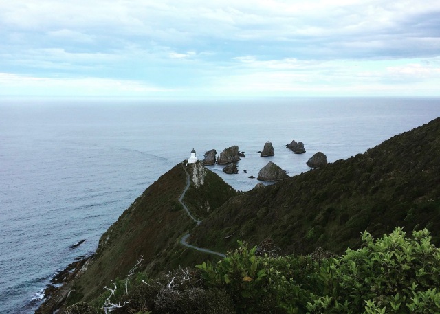
This is an easy walk, say thirty minutes one way if you have to park at the lower lot, twenty if you’re at the top. The walk is along the exposed ridge out to the lighthouse and the nuggets, past native trees and scrub. Sometimes you can spot fur seals on the rocks far below, but you can’t access the rocks. There’s also a short walk to a penguin viewing hide and walks along the beach back at Kaka Point, back along the road.
McLean Falls
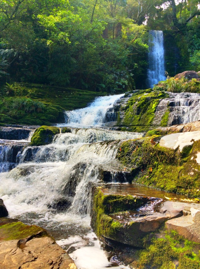
An easy walk through native bush to the spectacular McLean Falls. Other waterfalls in the Catlins include Purakaunui Falls and Matai Falls. All hikes are less than 2 hours round trip.
Slope Point
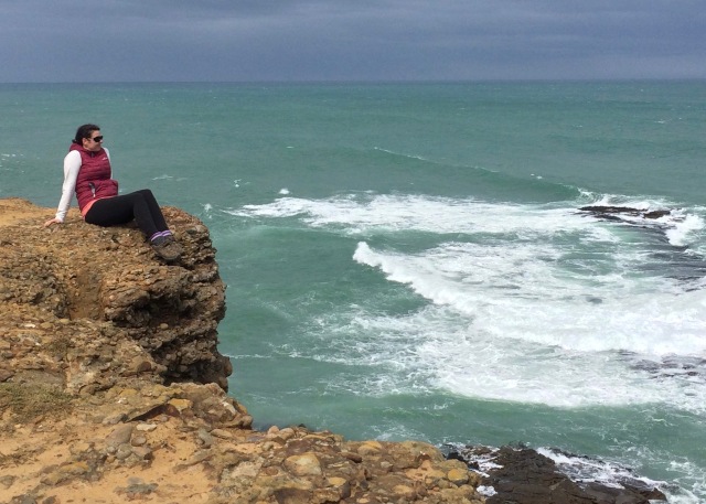
A short walk from the carpark brings you to Slope Point, the southernmost point on the South Island. It’s about 20 minutes one way, but the views out across the Southern Ocean and toward Stewart Island are incredible.
Southland
Mavora Lakes
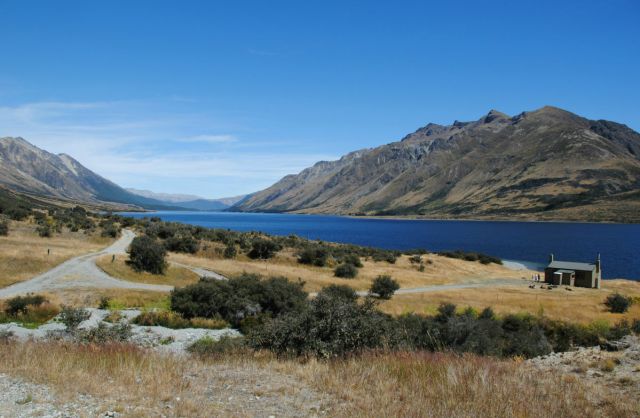 {image from DoC/New Zealand}
The Mavora Lakes are a Southland and Fiordland hiking, camping, and fishing spot. There is a 50km, 4 day hike that links the Mavora Lakes camping area with the Greenstone Trail, near Kinloch/Glenorchy. It passes through open valleys and beech forest, but isn’t an extremely challenging hike. The lakes themselves are in Southland and there are several easy short walks near there; the long trail ends in Central Otago and passes through Fiordland.
Fiordland
Hump Ridge Track
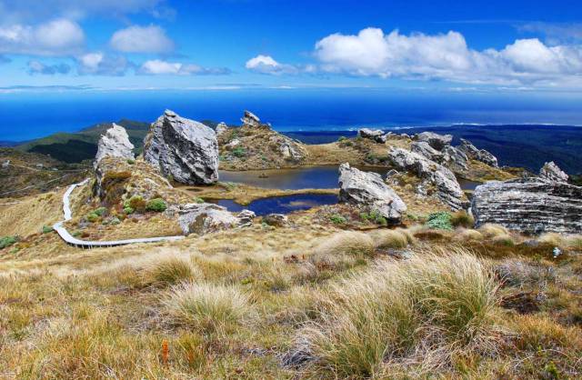 {image from DoC NZ}
The Hump Ridge Track is one of NZ’s newest hikes. It’s also different from the DOC walks in that its a private hike; you must book through the trust. The trail begins outside Tuatapere and ends in Fiordland. For the luxurious hiker, you can arrange for your bags to be transported via helicopter to each lodge. And, unlike other hikes across NZ, trampers have full access to these luxury lodges (book in advance!)
Stewart Island
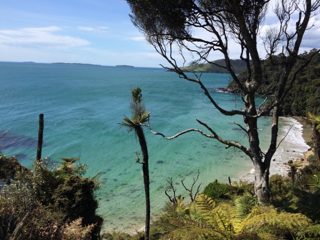
Rakiura Track
Woo hoo! Finally we get to talk about Stewart Island! The Rakiura track is one of New Zealand’s Great Walks, so I’ll only touch on it today before moving on.
If you only have a day, definitely do the Lee Bay to Maori Beach bit. It starts about one kilometre from town – which is an easy walk too. You get a great feel for Stewart Island flora and fauna even in that stretch. On my way back, I also did the Horseshoe Bay loop, which added two hours on to my time but it was great. Don’t miss Dead Man Beach.
The track follows open coastline, beaches, coastal forest, and interior brush. Stellar track and few people do it. Go!
PS. If you do get to Stewart Island and aren’t sure about the hikes, stop in to Ruggedy Range, right on Main Road (those Kiwis, so creative with their street names!) and have a chat about the gear you’ll need.
Next post, finally, I’ll share all the Great Walks! (Yikes, these posts have gotten longer and longer ;))
Like this post? Pin it!
