It was the perfect day for a hike. We awoke in the crisp autumn air, a slight icy condensation on the car windows, to a hazily clear sky and snow peaked mountains all around us. Taylor and I both knew we wanted to hike; what we didn’t know was which track. We had camped the night before at Lake Pearson, a pear-shaped lake set under the volcanic slopes of the northern Southern Alps. The evening before, as we set up camp in the quickly retreating daylight, I had noticed the crumbling scree on the conical hill opposite. In my mind, this was evidence of the previous lifetime the mountain range had enjoyed. We had also scampered among the granite boulders of Castle Hill earlier the day before. What else could this landscape be but volcanic?
I digress though. Like my mother, I have a habit of rambling on in stories. (Hi Mom!)
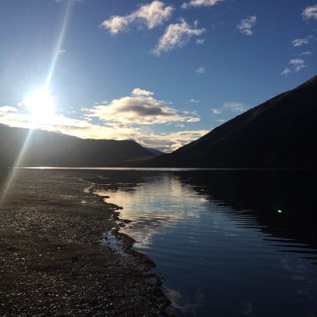
It was picture perfect. And the day was shaping up to be a stunner of a fall, sorry, autumn day. We had organised a car camping system the night before. After splitting from our third friend and second vehicle with the bigger bed, I moved into Taylor’s car and set up a new system for sleeping. This involved moving everything out of the boot into the front seats and/or leaving it outside overnight and laying down a series of blankets and duvets for padding and warmth. In the morning, we rolled the duvets over, crammed everything back in, and set off for Arthur’s Pass Village.
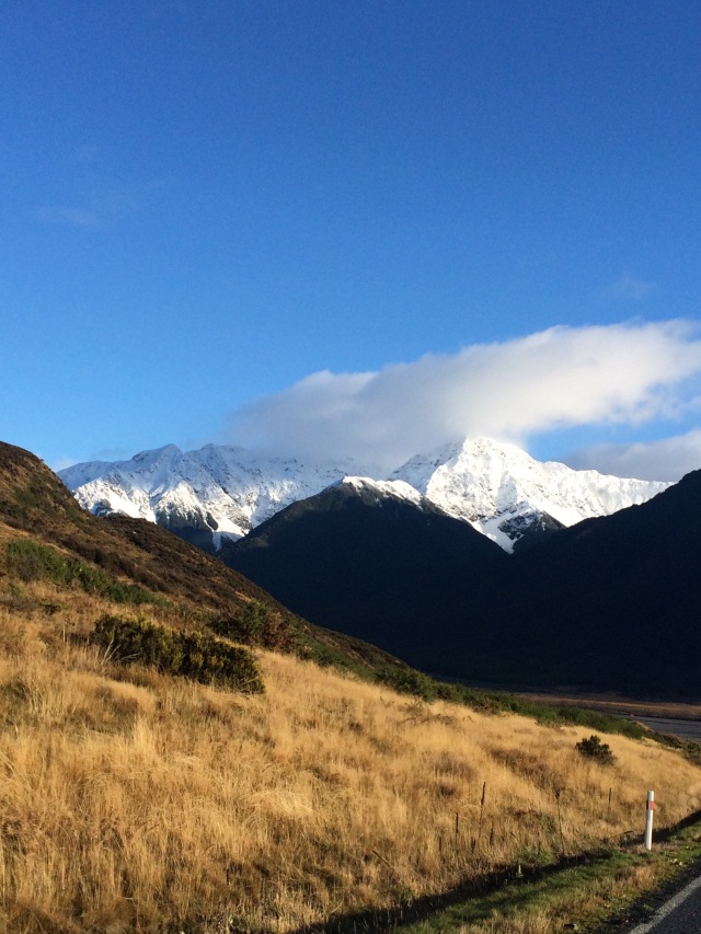
No more than a small collection of houses, cafes, and the DoC set alongside the Trans-Alpine rail tracks, the village isn’t much to write home about. What is worth it, however, is the maze of trails through the surrounding mountains, from long, multi-day hikes to shorter tramps. Each is unique in its own way, of course, and the helpful staff at the DoC can give insight into each one. One thing Taylor and I lacked after splitting from Tobyn was the morning coffees. No more would he make the coffee which inevitably got us up out of bed. Instead, we cruised into town and straight to the only open cafe. Two coffees later, we strolled back out and into the DoC. Rain had moved into the area, causing us to reevaluate our hike. A quick chat with the woman at the DoC confirmed our plans.
Instead of hiking the Devils Punchbowl track, or the Avalanche Peake track, we would head back out of town to the Bealey Spur track. She promised us the best views and better weather.
Settling into the car for the ten minute drive out to the carpark, we sipped our coffee in companionable silence. We left the clouds behind as well; it was as if the clouds had no desire to leave the gloominess of the dark pines and cascading falls near the pass, no cause to drift into the nearby river valley. At the carpark, we pulled cameras and bags from the car, packing our lunch into plastic bags for the trek up. Finally, we were ready.
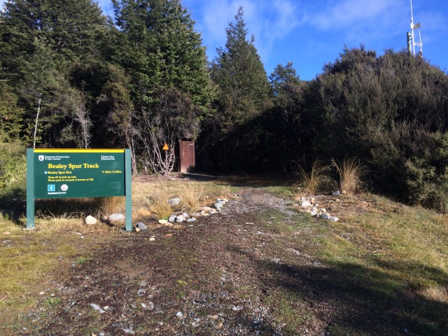
The trail itself doesn’t start at the carpark, a fact Taylor was blissfully unaware of until we began climbing the road – a narrow one-lane road that wove around the hillside among small houses with unrivalled views. Wildflowers still grew in the culverts on either side, hardy ones like red mistletoe. Mountain ones.
The trail began very unassumingly. A simple sign stating the distance and the time, and a small orange arrow leading us into the mountain beech forest. We climbed uphill for a bit, through watery muck and mossy tussocks. Branches and logs lay scattered across the forest floor and the autumn leaves padded our steps.
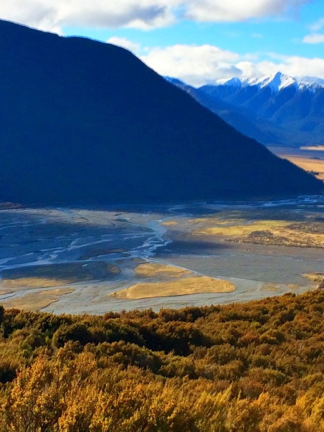
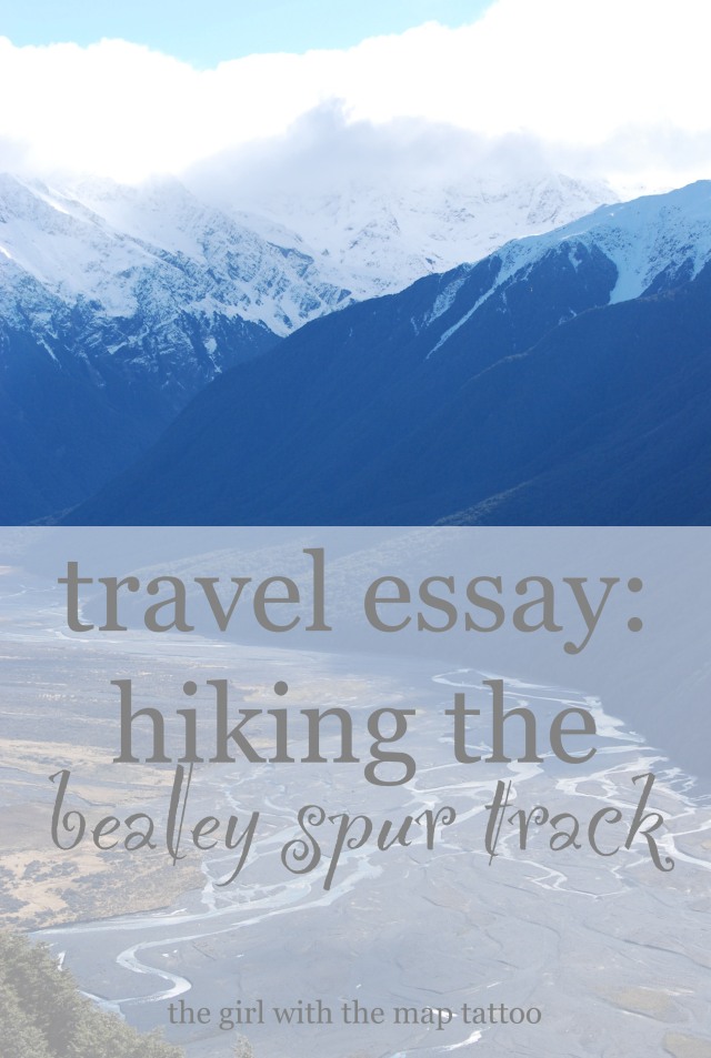
We broke out of the trees along a narrow cliff edge. We had crossed to the far side of the ridge and were walking along in tune with the rushing water of Bruce Stream below. We couldn’t see it, but we could hear its gushing falls. The manuka trees (and that is in fact what they are, I looked them up) grew along the inner edge of the track while the views across the gorge were of barren hillsides brown in the autumn sun. We climbed a slight rise and the valley floor fell out below us on the other side. The mountain streams criss-crossed the basin and glimmered in the sun, a veritable weave of water among grey rocky shores. The mountains opposite were snow-capped, offering a glimpse into the future of the region.

We paused here for a water break. I was hot at this point, having been in the sun for a mere minute; Taylor and I shucked off jackets and layers until the cold air hit our bare arms. I tied my rain jacket around my waist, totally 90s mom-style, and kept on trekking. Our trail wound into more trees. The trunks rose majestically into the sky, soaring above us in an emerald canopy. Back in the shadows, the chill crept back in. I trekked on, hoping my body would sense the workout and stay warm. We crossed more streams, walked along more logs, stepped across more rocks to avoid the rushing water. We climbed steadily higher.
Suddenly, we broke free from the darkness and emerged into an open bog. The summit was visible to our right, its snow capped peak jutting above the hill we had yet to climb. A boardwalk began here, its shadowed icy surface making way for the sunny bits that were dry. The boardwalk went on for quite some time. It crossed an open bog where, in the lea of the sun, ice crystals still formed on the golden grass. Small puddles formed here and there, reflecting the turf and the algae that grew wantonly across them.
The path went higher, grew colder. We entered the last forest, a glade of pines. Steps carved into the tree roots marked the path, orange triangles here and there confirmed it. Taylor commented that we hadn’t seen anyone else; within minutes we passed a young couple making their way back down. We said we hoped we were close to the hut; checking our timers, we were at our goal, closer still to the time allotted by the DoC.
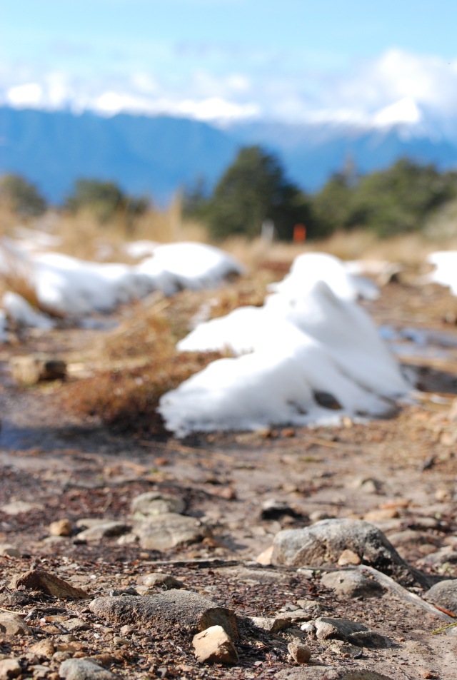
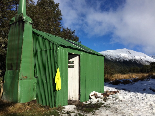
The path led uphill, the snow piles got higher, the ice crystals firmer. A glimpse of vibrant green in the shadows gave me pause and then I realised it was the hut. We left the shelter of the trees at the hut’s edge. It’s a simple hut; a sheep musterers hut from the 1920s. Its wooden beams inside are still as rugged as they were the day the hut was built. Names are written on the inside. At first, they are carved into the wood. Later they are written in pen and sharpie. Dates go back to the 1950s, the 1930s. People have been coming here for almost 100 years. the hut wasn’t DoC property until the late 1970s; these names are much older than that.
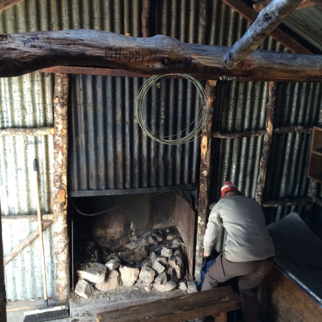
There were four other people at the hut. Two young women were just finishing their lunch and packing up to continue up the trail. From here, it is snow covered. A proper tramp. Two others, a French couple, pulled out a small pan, a small gas cooker, and began to make their lunch. Taylor and I unpacked our wraps, beef jerky, apples. We chugged some water and read the signs in the hut. No dogs. Keep the door open when cooking with gas. Sign the intentions book. This will help if you go missing, or if there is an accident. I pulled out a pen and wrote our names.
Sarah and Taylor. American and Canadian. A day hike. We’ll go back to the car park. What a beautiful hike. Stunning views. Great weather. We are so lucky.
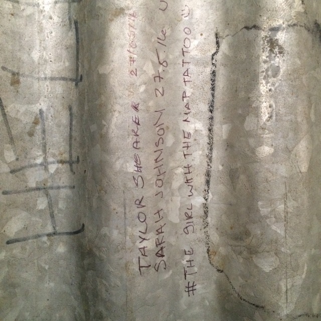
We also wrote our names on the wall. The date. Where we are from. I wrote The Girl With The Map Tattoo. Tay told me to hashtag it.
We packed our rubbish away – pack in, pack out – and I stepped outside to take some pictures. The hut was striking against the light blue sky. A bluebird day. Not a cloud to be found up there. The mountain was so close, I wanted to reach out and touch it. We weren’t going onward; Tay’s shoes were not the right sort of footwear for a snow tramp. Another time.
I could have stayed for hours. The silence, except for the wind in the trees. The kea, somewhere out there, we never did see one. The newly fallen snow, pure except for maybe ten footprints. We began to head back. Behind us, the French couple were still making lunch, the Asian and Polish women making their way back down from the summit. We left them behind, making a steady track for the base. The path down was the same as coming up. Ice still made the boardwalk slippery, the logs still rolled under my feet as I crept across the pond, the pines still smelled like Christmas, and the moss was brighter than ever in the mid afternoon sun.
Taylor and I walked back into the car park a solid three and a half hours after we departed. Sore and tired, in need of a stiff drink, we shed layer upon layer until we were in our thermals. We crawled into the car and headed into town for a whisky.
Like this post? Pin it!


4 thoughts on “travel essay: hiking the bealey spur track”
Comments are closed.